
I recommend traveling the loop clockwise. The cross-country section between Alta Mountain and Chikamin Pass is easier this way, the more challenging sections (in terms of navigation and terrain) will be in the first half of the loop, and the second half of the loop will be along relatively easy trails down Mineral Creek and along Little Kachess Lake.
The section between the tarns below Alta Mountain and Chikamin Pass merits a little more detail as well:
-traces of very old trail and the occasional cairn mark the way from below Alta Mountain until Chikamin Pass but overall it's effectively cross-country travel. The faint trail that climbs to Box Ridge is visible on the slopes east of the tarns below Alta and several of its switchbacks are hard to miss higher up. Once on the north side of Box Ridge, the trail starts out strong but then disappears quickly. I recommend continuing north towards Chikamin Pass, staying above treeline and traveling across talus fields, for the easiest route but it's also possible to drop to Park Lakes (through heavy brush) or stay high along the ridge (with much more scrambling and exposure).
Distance: 22 miles for just the loop but closer to 30 with the side trips, which are the highlights of the route
Elevation Gain: ~6,500' for just the loop and around 11,000' for the loop and both side trips
Maps and More:
- 1x31680 scale (1 inch = 0.5 mile)
- Mileage, elevation gain, and route details
Overview Map:
Trailhead: https://goo.gl/maps/oVIfi

Rachel Lake

Chikamin Peak and Four Brothers from Alta Mountain
Looking south along the ridge leading to Alta

Box Ridge from near the tarns below Alta Mountain. The path up Box Ridge heads across the grass slope on the left side of the picture.

Alta Mountain, Rampart Lakes & Ridge, and Mount Rainier

Looking back at Rampart Ridge & Lakes, from the top of Box Ridge

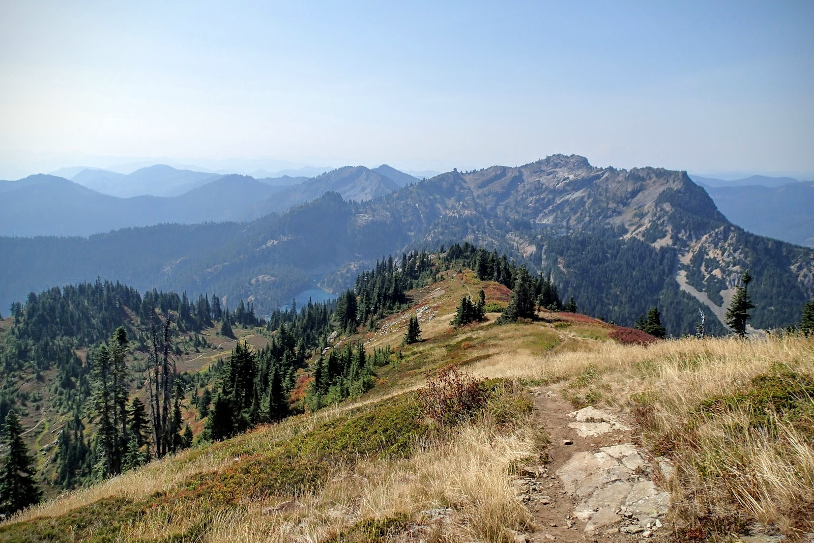
Chikamin Pass and beyond from Box Ridge. The xc route follows the east (right) side of the ridge in the center of the photo, mostly right above the tree line

Park Lakes and Box Ridge from Chikamin Pass

Joe Lake below Mount Thomson, with Huckleberry Mountain to the right

The unofficial trail leading to Glacier Lake

Glacier Lake

The route to Chikamin Peak goes to either side of the "monolith"

Easy cross-country on slabs and heather, on the way up to Chikamin Ridge

Chikamin Lake and beyond, from the summit of Chikamin Peak

Glacier and Spectacle Lakes from the summit of Chikamin

The crux of Chikamin Peak, a short and easy section of Class 3 scrambling

Denny Rock, inscribed by Rolland Denny in 1899. More info here

Along the Little Kachess Trail

Little Kachess Lake

Box Creek, a difficult crossing earlier in the summer
More info:
http://www.hikingwithmybrother.com/2009/08/rachel-lake-alta-mountain.htmlA few trip reports describing the Alta Mountain-to-Chikamin Pass section:
http://www.nwhikers.net/forums/viewtopic.php?p=835061
http://www.nwhikers.net/forums/viewtopic.php?p=953298
http://www.nwhikers.net/forums/viewtopic.php?p=1014049
http://www.summitpost.org/chikamin-peak/151849
This comment has been removed by a blog administrator.
ReplyDeleteThis is wonderful place that i had visited during my weekend. I also visited some more places that you could visit from http://bit.ly/2yHXaZ0 here. This place is also full of natural destination and perfect place for planning a outing.
ReplyDeleteRespect and that i have a super offer: What To Expect When Renovating A House whole home renovation cost
ReplyDelete