If you've ever looked at the Gold Creek valley and thought to yourself "I'd really like to circumambulate that watershed.", well, here's your chance. Around 22 miles of travel on trails and cross-country will take you from the Mount Margaret Trailhead below Rampart Ridge to the Pacific Crest Trail trailhead at Snoqualmie Pass and another ~7.5 miles on roads will get you back to your car. The travel from Mount Margaret to Snoqualmie Pass is packed full with incredible Alpine Lakes Wilderness scenery, lakes, challenging-but-fun navigation, and several possible side trips to viewful summits. I suggest doing the loop counter-clockwise: the challenging cross-country travel between Alta Mountain and Chikamin Pass is easier this way and you'll tackle the hardest parts of the loop earlier on, then be rewarded with relatively smooth travel on the PCT later on.
A few sections require a little more detail:
-There is an abundance of trails
between Lake Lillian and Rampart Lakes, none of which are official or maintained. I've highlighted one possible option but you'll find several other trails branching off of and rejoining your path. As long as you're heading generally north and not losing too much elevation, you're going in the right direction.
-Traces of very old trail and the occasional cairn mark the way
between the tarns below Alta Mountain and Chikamin Pass but overall it's effectively cross-country travel. The faint trail that climbs to Box Ridge is visible on the slopes east of the tarns below Alta and several of its switchbacks are hard to miss higher up. Once on the north side of Box Ridge, the trail starts out strong but then disappears quickly. I recommend continuing north towards Chikamin Pass, staying above treeline and traveling across talus fields, for the easiest route but it's also possible to drop to Park Lakes (through heavy brush) or stay high along the ridge (with much more scrambling and exposure).
There are two alternate ways to finish this loop:
1. Exit via Joe Lake and the Gold Creek valley. It's a bit of a rough descent down to Gold Creek but this route will save you from some road miles. See
Joe Lake Loop for more info
2. Exit via Kendall Peak Lakes. A short section of cross-country will connect the PCT south of Kendall Peak with Kendall Peak Lakes, where a good trail will take you back to Forest Road 4832. I haven't done this route yet myself so I won't describe it further, but it should be a relatively straightforward piece of cross-country to make it possible.
Distance: 30-ish including the road, 22-ish if you shuttle between trailheads
Elevation Gain: 9,700'-or-so for the full loop, about 1,000' less if you do a shuttle
Maps and More:
Overview Map:
Trailhead: https://goo.gl/maps/4ozTA
Sign at Mount Margaret Trailhead
Mount Rainier from Mount Margaret side trip
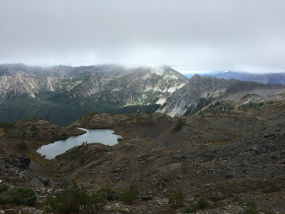
Upper Rampart Lakes
Rampart Lakes
Box Ridge from near the tarns below Alta Mountain. The path up Box Ridge heads across the grass slope on the left side of the picture.
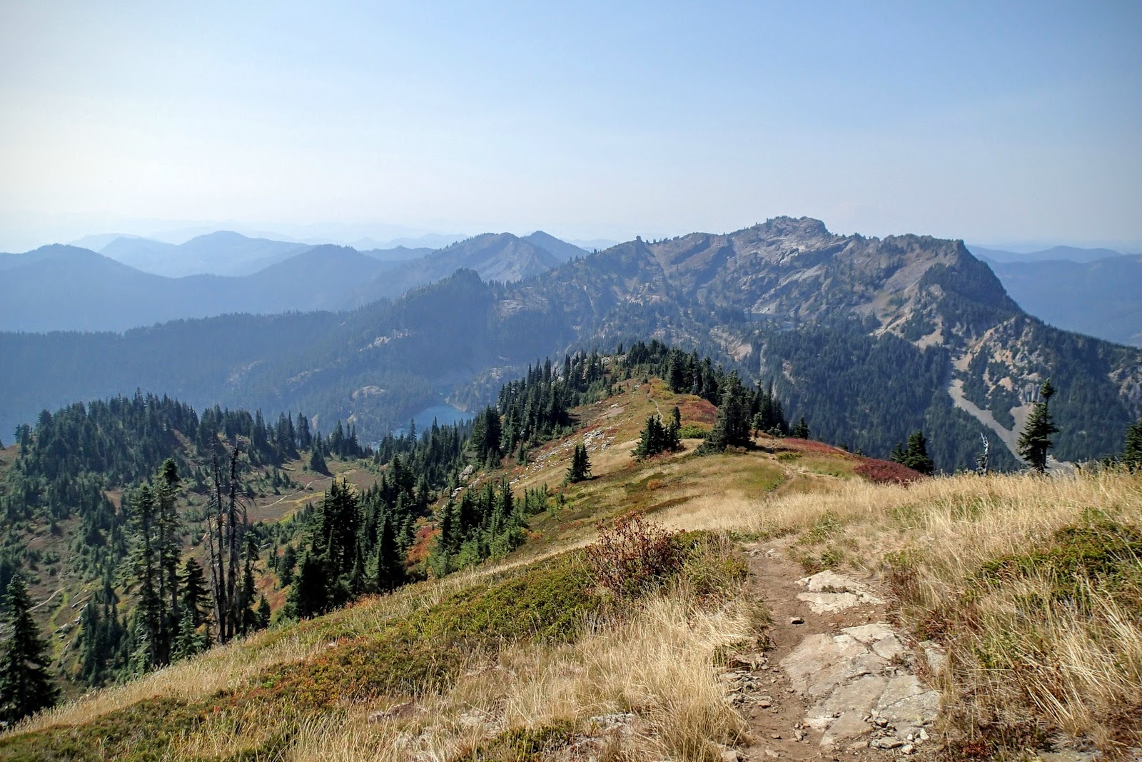
Alta Mountain, Rampart Lakes & Ridge, and Mount Rainier
Looking back at Rampart Ridge & Lakes, from the top of Box Ridge
Chikamin Pass and beyond from Box Ridge. The xc route follows the east (right) side of the ridge in the center of the photo, mostly right above the tree line
Park Lakes and Box Ridge from Chikamin Pass
Joe Lake below Mount Thomson, with Huckleberry Mountain to the right
More info:
http://www.hikingwithmybrother.com/2009/10/margaret-lake.html
http://www.summitpost.org/mount-margaret/533363
http://www.hikingwithmybrother.com/2010/07/lake-lillian-mt-margaret-trail-1332.html
http://www.summitpost.org/alta-mountain/151394
http://www.hikingwithmybrother.com/2009/08/rachel-lake-alta-mountain.html
A few trip reports describing the Alta Mountain-to-Chikamin Pass section:
http://www.nwhikers.net/forums/viewtopic.php?p=835061
http://www.nwhikers.net/forums/viewtopic.php?p=953298
http://www.nwhikers.net/forums/viewtopic.php?p=1014049
http://www.summitpost.org/chikamin-peak/151849